


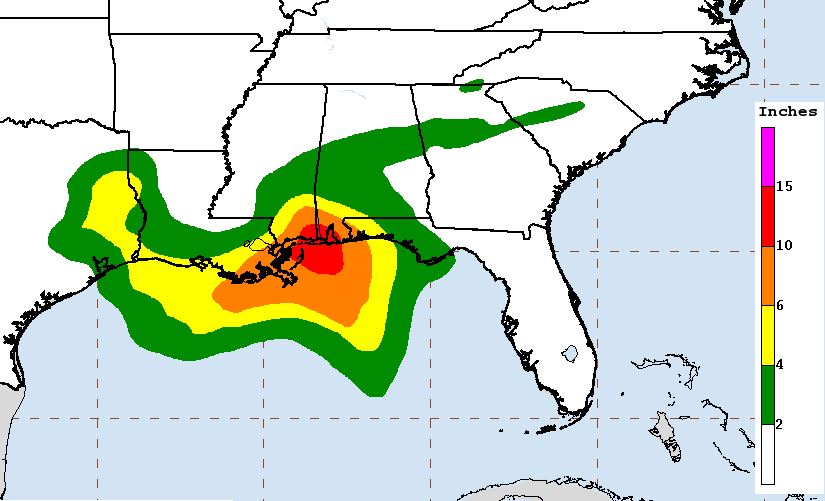
GRAPHIC: Rainfall projections through Thursday morning
Later today a potential tropical cyclone in the Gulf of Mexico could become Tropical Storm Cindy if a “well-defined” center of circulation develops.
Despite projected landfall tomorrow night along the Texas and Louisiana border, the latest advisory from the National Hurricane Center forecasts accumulations of 6 to 9 inches of rain with isolated maximum amounts of 12 inches over southeastern Louisiana, southern Mississippi, southern Alabama, and the Florida Panhandle through Thursday.
According to the National Hurricane Center, at 10 a.m. CDT the disturbance was centered near latitude 25.9 North, longitude 90.5 West. The system is moving toward the northwest near 10 mph, but a turn toward the north-northwest is forecast early Thursday.
Other NHC data about the storm:
-Maximum sustained winds are near 40 mph with higher gusts
-Some slight strengthening is possible before the system reaches the coast.
-Tropical-storm-force winds extend outward up to 205 miles — mainly to the north and east of the center
-The estimated minimum central pressure based on buoy data is 999 mb (29.50 inches)
The next NHC update will be issued at 1 p.m. CDT