


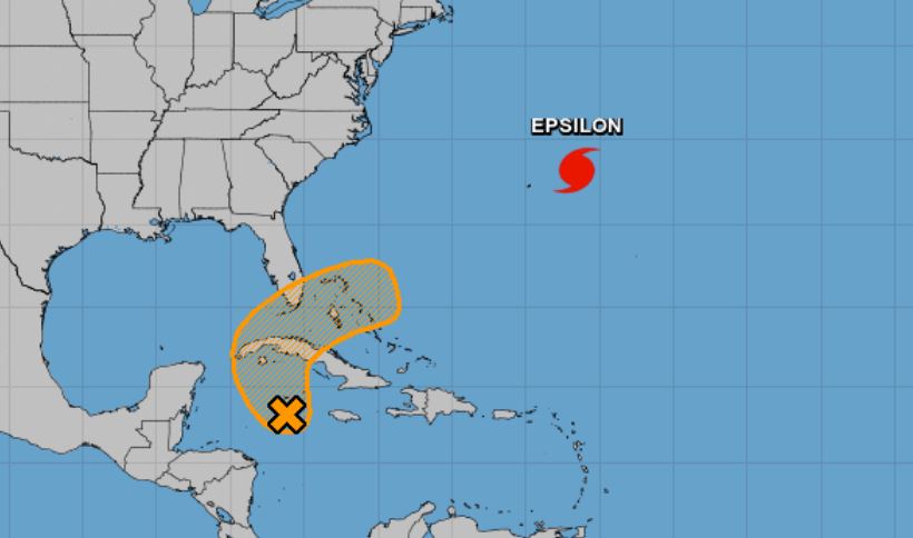
A broad trough of low pressure, located over the western Caribbean Sea, is producing a large area of showers and thunderstorms mainly east of the trough. Surface observations, satellite-derived surface wind data, and radar data indicate that a low pressure system has developed along the trough axis just south of Grand Cayman Island. Some gradual development of the low is possible during the next few days while it moves northwestward to northward across western or central Cuba on Saturday, then turning northward to northeastward across the southeastern Gulf of Mexico, Straits of Florida, and the central Bahamas on Sunday. Regardless of development, locally heavy rainfall will be possible over portions of the Cayman Islands, Cuba, South Florida, and the Bahamas through early next week.
* Formation chance through 48 hours…low…30 percent.
* Formation chance through 5 days…medium…40 percent.
The National Hurricane Center is also issuing advisories on Hurricane Epsilon, located over the west-central Atlantic about 200 miles east of Bermuda. For more information click here: HURRICANE EPSILON UPDATE


