


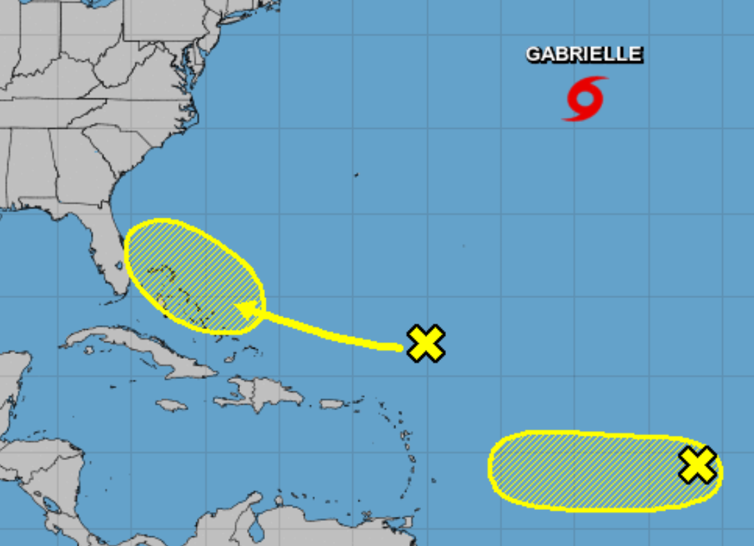
Per the National Hurricane Center’s 2 a.m. EDT update:
1. A weak area of low pressure, associated with a tropical wave, is producing disorganized showers and thunderstorms about midway between the Cabo Verde Islands and the Windward Islands. Some slow development of this system is possible during the next few days before upper-level winds become unfavorable for tropical cyclone formation. This system is expected to move generally westward across the tropical Atlantic Ocean during the next several days.
* Formation chance through 48 hours…low…20 percent.
* Formation chance through 5 days…low…30 percent.
2. Disorganized cloudiness and showers located a few hundred miles north and northeast of the northern Leeward Islands are associated with a surface trough interacting with an upper-level low. Strong upper-level winds are expected to prevent the development of this system during the next few days while it moves west-northwestward to the north of the Leeward Islands and Puerto Rico. However, environmental conditions could become a little more favorable for development when the disturbance moves near the Bahamas and Florida late this week.
* Formation chance through 48 hours…low…near 0 percent.
* Formation chance through 5 days…low…20 percent.


