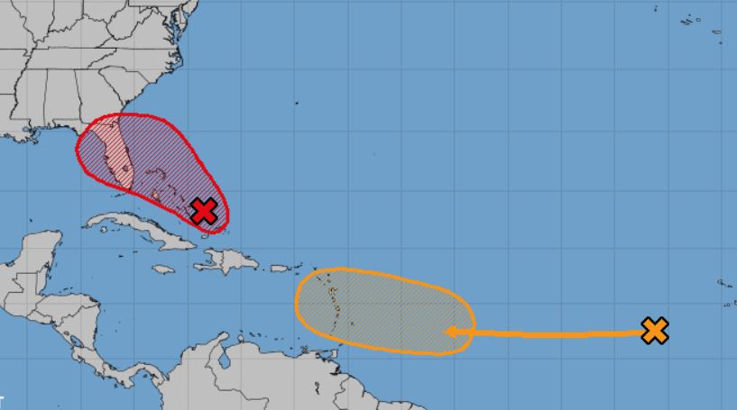
The 2 p.m. EDT Tropical Weather Outlook from the National Hurricane Center indicates
The update states: Satellite derived winds and surface observations indicate that the disturbance in the Bahamas has not yet developed a closed circulation, and that the winds are not strong at this time. However, surface pressures remain low and environmental conditions are favorable for a tropical depression or tropical storm to form within the next day or two as the system moves toward the northwest at 5 to 10 mph through the northwestern Bahamas and toward the Florida Peninsula.
NHC reports that Potential Tropical Cyclone advisories could be needed today or Friday, and that Floridians should monitor the progress of this disturbance.
An Air Force Reserve reconnaissance aircraft is scheduled to investigate the system later today.
* Formation chance through 48 hours…high…70 percent.
* Formation chance through 5 days…high…80 percent.
Following is a link to Santa Rosa County Emergency Management’s disaster preparedness information for hurricanes:


