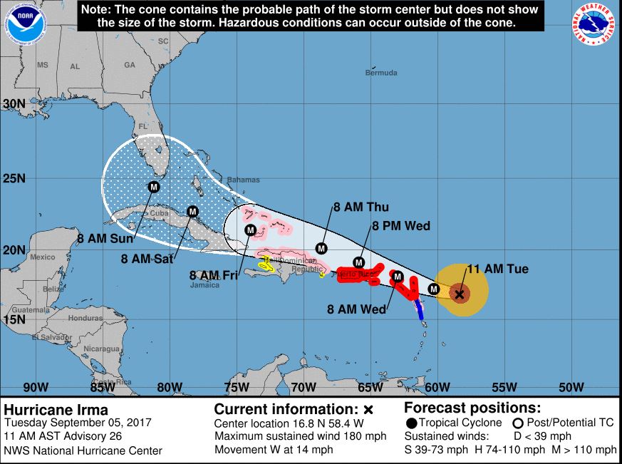
Irma is now the strongest hurricane in the Atlantic basin outside of the Caribbean Sea and Gulf of Mexico in National Hurricane Center records, her the agency’s 10 a.m. update.
“At 10 a.m. CST the eye of Hurricane Irma was located near latitude 16.8 North, longitude 58.4 West. Irma is moving toward the west near 14 mph (22 km/h), and this general motion is expected
to continue today, followed by a turn toward the west-northwest tonight. On the forecast track, the extremely dangerous core of Irma is forecast to move over portions of the northern Leeward Islands tonight and early Wednesday,” stated the update.
According to NHC Forecaster Daniel Brown, reports from an Air Force Hurricane Hunter aircraft indicate that the maximum sustained winds are near 180 mph (285 km/h) with higher gusts. Irma is a an extremely dangerous category 5 hurricane on the Saffir-Simpson Hurricane Wind Scale. Some fluctuations in intensity are likely during the next day or two, but Irma is forecast to remain a powerful category 4 or 5 hurricane during the next couple of days.
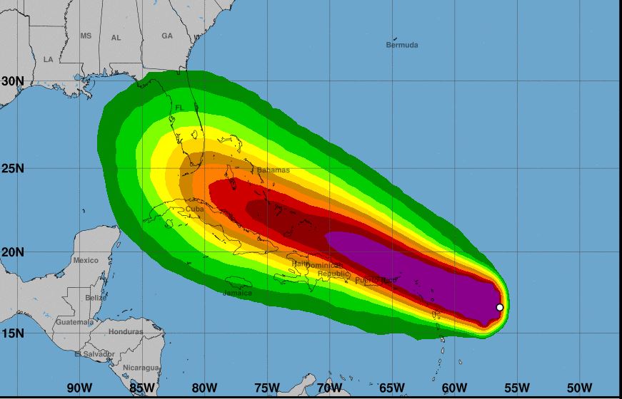
“Since Irma is a large hurricane, users are reminded to not focus on the exact forecast track since tropical-storm and hurricane-force winds and life-threatening storm surge extend far from the center,” stated Brown.
Hurricane-force winds extend outward up to 60 miles from the center and tropical-storm-force winds extend outward up to 160 miles, and minimum central pressure was 931 mb, stated the update.
The next update will be at 1 p.m. CST.