


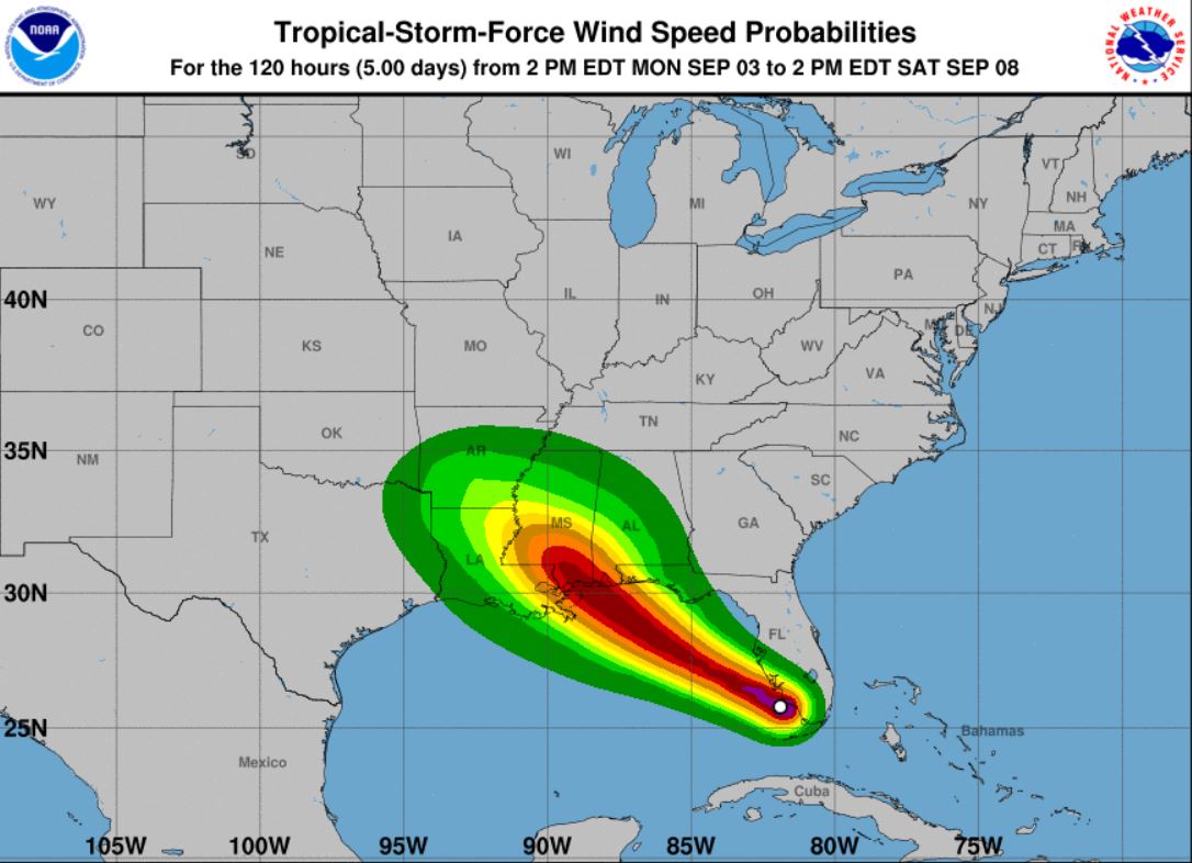
The National Hurricane Center’s 5 p.m. EDT advisory for Tropical Storm Gordon includes a newly issued storm surge watch east of Dauphin Island, Alabama to Navarre, Florida. A Tropical Storm Warning also remains in effect for the local area.
Presently T.S. Gordon is located about 445 miles ESE of the mouth of the Mississippi River with maximum sustained winds of 50 mph, and the storm is moving WNW at 17 mph, per NHC.
“Gradual strengthening is forecast during the next 36 hours, and Gordon is expected to be a hurricane when it makes landfall along the central Gulf Coast,” stated NHC Forecaster Stacy Stewart in the advisory.
According to Stewart, the west-northwestward to northwestward motion is expected over the next 72 hours.
“On the forecast track, the center of Gordon will move farther away from the southwestern coast of Florida early this evening, and move across the eastern Gulf of Mexico tonight and Tuesday. The center of Gordon will approach the central Gulf Coast within the warning area late Tuesday or Tuesday night, and move inland over the lower Mississippi Valley on Wednesday,” Stewart said.
Per NHC, tropical storm conditions are expected within portions of the central Gulf Coast warning area by late Tuesday, with hurricane conditions expected late Tuesday or Tuesday night in the hurricane warning area.


