


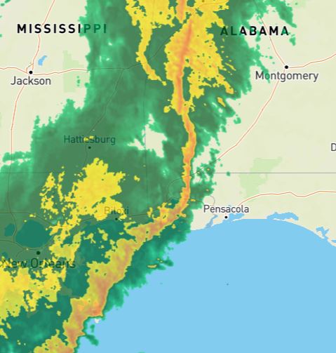
Ahead of a strong line of storms expected to move through our area today, the U.S. National Weather Service in Mobile, Alabama has issued several local weather alerts, including a tornado watch effective until 1 p.m. High rip current and surf advisories have also been issued.
The NWS’s November 1 hazardous weather outlook stated numerous to widespread showers and thunderstorms will spread into the region this morning into the early afternoon.
NWS reports showers and thunderstorms will occur mainly between 10 a.m. and 4 p.m. and conditions will be windy, with a south wind 20 to 25 mph, with gusts as high as 35 mph. Chance of precipitation is 90 percent.
Some of these storms could become severe with damaging winds and possibly a tornado or two. Locally heavy rainfall could lead to localized flash flooding, stated the report.
Monitor a NOAA Weather Radio or visit weather.gov/mob for more details.


