


Graphic by weather.com
Hurricane Hunters were unable to locate a well-defined center inside the low-pressure system which is expected to develop into Tropical Storm Isaias tonight or tomorrow.
According to the latest update from the National Hurricane Center, new clusters of convection have developed over the northern portion of the elongated circulation.
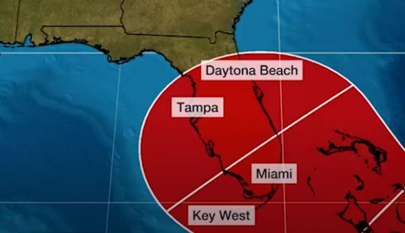
According to NHC Forecaster Dan Brown, changes in both the track and intensity are likely. “The global model guidance suggests that the system will consolidate overnight and should acquire a better defined center. As this occurs, the disturbance is likely to gradually strengthen,” he said.
Brown stated that a stronger cyclone is likely to favor a more northern track, while a weaker system is likely to remain more equatorward. Additionally, he noted the long-term average NHC track forecast errors at days 4 and 5 are 140 and 175 nautical miles, respectively.
Presently the disturbance is centered near latitude 14.4 North, longitude 55.9 West. The system is moving toward the west-northwest near 23 mph (37 km/h), and this general motion with some slight reduction in forward speed is expected over the next few days.
Maximum sustained winds are near 40 mph (65 km/h) with higher gusts.
Environmental conditions are expected to be conducive for additional development and a tropical storm is forecast to form tonight or Wednesday.
* Formation chance through 48 hours…high…90 percent
* Formation chance through 5 days…high…90 percent
Tropical-storm-force winds extend outward up to 230 miles (370 km) primarily to the northeast of the center.
The estimated minimum central pressure is 1007 mb (29.74 inches).


